Nepal sent its disaster alert 38 minutes after the glacier collapse. It wasn’t enough
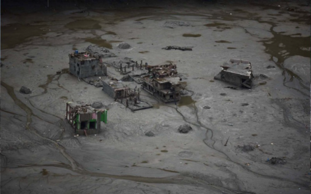
Nima Dorje Tamang was in Hakubesi, a hamlet south of Syafrubesi in Rasuwa, when the flood struck. Before Tamang could prepare, he heard a thunderous roar and saw the flood gushing toward him, its waves taller than him.
Tamang and his family ran uphill for their lives but the waves caught him and a rock struck his leg, fracturing it. Swept into the river, he managed to grab a tree near the bank and clung to it for what felt like two hours until his father and his brother came to rescue him. For the next 24 hours, he said he slipped in and out of consciousness before a helicopter brought him to Kathmandu.
At the orthopedic inpatient ward of Tribhuvan University Teaching Hospital, Tamang told the doctors, “Even the air makes it hurt,” when they pressed his left foot. It was still swollen after the surgery. But from his hospital bed, Tamang worried about his family back home. “We lost our uncle, aunt, sister, and brother-in-law,” he said. “And everyone says there will be a massive flood again.”
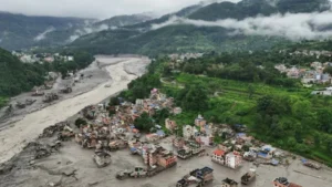
Like Tamang, communities and authorities were caught off guard when the glacier collapsed at 8:37 AM on August 26. Scientists say the likelihood of predicting this particular type of disaster was minimal, and the resulting flash flood surged so rapidly through the steep mountain terrain that there was little time to warn communities downstream. But the disaster exposed a deeper problem: Nepal’s warning systems remain largely designed around individual hazards, while disasters in the Hindu Kush Himalaya are becoming increasingly complex, cascading and transboundary.
“There is no such thing as an early warning system in Nepal. Simply having sensors does not mean it’s a system; it has to be much more comprehensive,” said Anil Pokhrel, former chief executive of National Disaster Risk Reduction & Management Authority (NDRRMA), stressing the word “system.” For it to be a system, it needed to have a proper assessment of who and what is at risk, he said, then an observation system to anticipate hazards in real time, a comprehensive communications plan for timely alerts, and preparedness for emergencies.
“If the Chinese sensors detect something upstream, a series of sirens should automatically go off all at once. Text messages should go off with a loud buzzer even if it is on silent mode,” he added.
Over the last decade, Pokhrel said Nepal had invested a lot on the observation side, installing sensors. Without multiple sets of sensors monitoring different hazards across different locations, as we saw with Rasuwa floods, it is inadequate to save lives.
When the massive glacial collapse hit the Lhende valley, near the Nepal-Tibet border, Nepal’s Department of Mines and Geology recorded seismic activity. “Our records showed a 4.4 magnitude. But the frequency of the seismic activity did not match that of an earthquake, which is the department’s monitoring mandate, so we did not alert the public like we usually do,” said Lok Vijay Adhikari, chief of National Earthquake Monitoring and Research Center in the Department of Mines and Geology. The US Geological Survey also initially recorded the event at magnitude 4.4, but later revised its assessment, attributing the seismic activity to the glacial collapse.
In the minutes that followed, rising water levels in Bhotekoshi in Rasuwa could potentially have provided another opportunity to alert the public. It was the same Lhende Khola, a transboundary high-altitude river that originates in Gyirong County in Tibet and flows toward the Nepal border, feeding into Bhotekoshi as well as Trishuli downstream. But at 8:50 AM, the flash flood swept away the gauge in the Bhotekoshi river in Rasuwa, at the Syabrubesi hydrological station. Designed to detect gradual rises in the rivers, the gauges were ill-equipped to detect the high-speed flood.